So this is it. This is finally the last day of us hiking the Alpe Adria Trail. It’s the first long distance hike we’ve done. We’ve been on hiking holidays very often but always with one fine hotel as “base camp” and then doing some daily hikes. I’ve never thought that we won’t make it, I just took one day at a time. And so, after 44 days we now were right before finishing our first thru-hike.
The night at Alexia’s Air B&B was really great, it was so quiet and we slept so well with the window open. There weren’t even church bells to wake us. 😂
When we went down at 7 a.m. breakfast was already waiting for us. We talked a little with our awesome hosts (those guys are so lovely and helpful!!!) before they left and we filled our stomaches for our last day. They even bought good bread (yeah, the real stuff!) for us because they said Italians only like this white bread but we being Austrians probably not so much. 😉
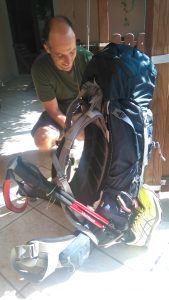
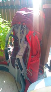
Then we packed our backpacks for the last time on this trail. It felt nostalgic – I’ve so got used to pack it within 1 or 2 minutes thank to our perfect dry sack system. And after the first days you know exactly where to put what due to its use. And you don’t need so many clothes during a thru-hike, life has definitely become so easy and simple. I’m gonna miss that. And man, a lot of other things, too!!!
We decided that we would do an extra tour to the Monte Carso since our guidebook described the last day on the trail as “notably less grand”.
So we left our backpacks at the Air B&B to pick up on our return and headed off, at first around 1,5km into the route for this day. It was early morning and the wind was blowing so it was comfortably cool. And without the weight on our backs hiking was nearly too easy. 😉
The path led very nicely through the forest and 400m uphill onto 447m. It was really easy to hike and very soon we arrived at the top of Monte Carso with a great view to Trieste, Muggia, the sea…
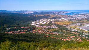

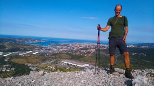
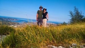
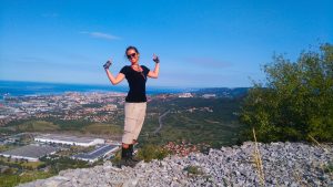
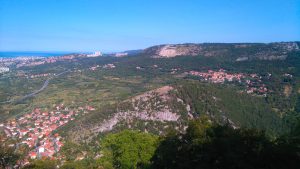
There was no one around, we only heard the wind blowing. It was wonderful, and we were grateful for this suggestion in our guidebook.
After writing into the summit register we chose the path for our way down again. We decided to follow the Via Alpina path to Bagnoli Superiore. Well, this path wasn’t so easy and comfortable anymore. At first we nearly cut our way through some dense undergrowth and over fallen trees and cut our legs quite often on some brambly bushes. I think I’m now prepared for the jungle. 😉
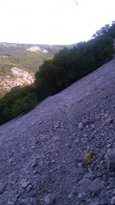
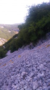
And then the real fun began. For 30-40 minutes we hiked over a steep, very rocky path through this typical Karst region. It was not really difficult or dangerous but you had to step carefully. Yes, these pictures really show a path:
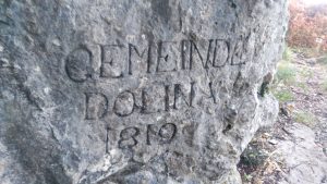
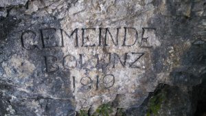
Somewhere along the way we saw a cave with the following insignia, a shelter from the WW2:
When we were back down again we had just a short 10 minutes hike to our B&B. This detour was about 6km but so worth it! We were glad to have decided to add this route on our last day.
Then we picked up our backpacks and really started the last day on the AAT.
At first we walked the same path like before on the Monte Carso but at a junction chose the other way to Muggia. We continued through the forest until San Dorligo della Valle for 2km which was quite nice since it was already around noon.
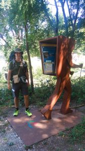
After leaving the forest we saw the Italian AAT information point again because in some former routing of the AAT it would have ended here in San Dorligo.
After a few metres up a street we followed the AAT marking into another forest again. And that’s where our little routing problem for today began.
There was suddenly not a single trail marking to be found but lots of junctions with paths to choose and several other markings with no real hint. So we followed our GPS tracks which proved to be the wrong decision. We followed a path for about 1km before we didn’t see markings anymore. And the GPS tracks still seemed to be correct but we didn’t trust it anymore. So we tried to hike directly up through the dense forest without any way hopefully find the other path without having to return.
Didn’t work either. So back through the undergrowth again and back the whole wrong track.
Then we went other path, hoping that somehow this way would prove to be the right one. After 1km through the forest on this path finally we saw the AAT marking again! Phew…
The rest of the way to Muggia was rather uninspiring. After the forest path we arrived in a tiny village and hiked in a zig zag way downhill.
Then we thought that after this wrong tour through the forest we earned a little shortcut. Instead of hiking a senseless longer edge of the AAT we chose to hike the marked Via Alpina. Somewhere on the last few metres it became a jungle again and I really had to use my hiking poles to cut down all the brambly bushes in our way. Mind you, it was actually a marked official hiking path! And then suddenly we stood in front of a closed gate. It was just 10m but two closed gates were between us and the correct street. Felix first tried to bypass it but I recognised that didn’t work too well. So I just threw my backpack and my hiking poles over the gate with a height of about 1,5m and climbed over it. The same procedure at the second gate. Well, I didn’t train my core for nothing. 😉 Then I called to Felix to return and just climb over the gates as well. After all, the hiking path led this way!
Then after a few metres on the street we very soon entered a forest path again. But only for a short time because then we suddenly emerged at a very uncharming industrial area which we had to walk for 1,5km. 😒
This uncharming part ended with following a road down under the motorway. But here again the path was blocked due to road works in this area. Now I couldn’t give a damn anymore. Since it was obvious that quite some other people had climbed over the barriers we did the same.
And finally, we were on a nice normal hiking path again leading uphill for 2km before reaching Santa Barbara. And from there it was just downhill on a street straight to Muggia! We headed straight into the direction of the sea!
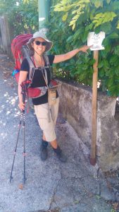
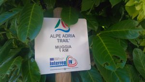
And then there was only 1km left:
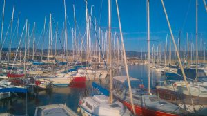
And against all odds, we really reached Muggia after 872km, more than 33.000m each up and down and after 45 days on the trail. The best moment was when we headed for the last AAT information point some people passing smiled at us and said: “buen camino”.

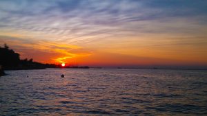
And then for some minutes we just sat at the sea. We’ve made it.
At 4 p.m. we met our host Monica at the Air B&B we now had for 2 nights in Muggia and she showed us the big flat in the historic center of Muggia. We showered, ate something (Monica gave us a glass of her homemade cherry jam) and then went shopping for breakfast for the next two days.
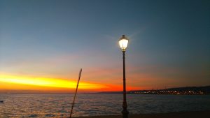
For the rest of the evening we mostly just sat at the sea until the sun had set. (With food, french fries and icecream, of course. We are hungry hikers after all. 😂)
Now, it’s done. We thru-hiked the Alpe Adria Trail!!! Tomorrow we will gather our highlights and a conclusion on this trail that sometimes wanted to show us our limits but never succeeded. And that was one awesome, gorgeous, adventurous, exciting rollercoaster ride in so many ways!
Some figures for today:
- 24,5km
- 770m up
- 850m down
- Hiking time: 5h 47m