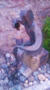
We slept so great this night until the church bells rang at 6 a.m. 😉 Before breakfast we did some shopping at the small supermarket of Arriach, just across our accomodation. Bananas, chocolate and crisps – all the healthy food of a long distance hiker. 😂 There we also met this thirsty guy:
Breakfast was great at the Alte Point! The choice of muesli was incredible and by far the best on the trail until now! We got stuffed and then started our way to the Gerlitzen. The other AAT hikers that stayed at the Alte Point were already on their way but we soon overtook the girls from Upper Austria.
The first part was on asphalt and next to the road without pedestrian lane and therefore rather unexciting. Then the ascent began on some long winding asphalt roads at first.
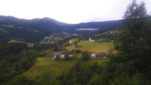
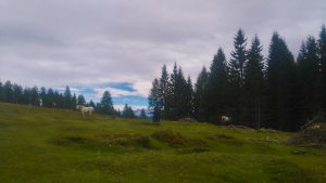
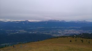
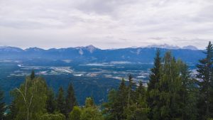
Somewhere along this way we had some nice views, also down Arriach:
After a while we finally left the boring asphalt road and hiked a 4×4 road again in winding roads up and up and up… The way was rather uninspiring, too, but not too steep and easy walking.
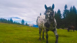
After the end of the 4×4 road we got onto a very nice way through the forest and on alpine pastures. There were also horses up there. 😍
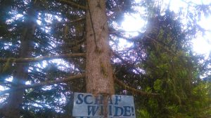
And I also found sheep, finally! Ok, we saw one, far below but the sign was clear:
After 3 km of hiking through the forest we came to a small hut and stopped for lunch. It was nothing fancy but we were hungry and we knew the place from a former visit to the Gerlitzen. Only that this time there was no sun, the wind was blowing and it was much too cold for July!!! We only stopped for half an hour before we made the last ascent of 400m up to the top of the Gerlitzen.
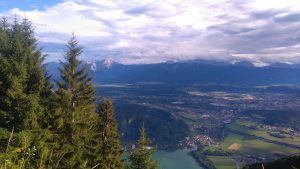
Up there were quite many people because of the cable cars coming all the way up to the top. We walked shortly around to have some nice views down but with an icecold wind blowing we couldn’t enjoy it much. So we just took some photos and started descending again.
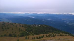
The Gerlitzen is more famous for Winter than for Summer tourism and not the prettiest hiking area. There are a few nice spots, mostly below the top in the forest but the top is really just too crowded and the only fine thing is the view.
Actually, today’s stage would have been over now but we had an accomodation more below the peak. In fact, 400m in height below! The accomodations directly on the Gerlitzen were way too expensive so I chose a cheaper one.
At first we went rather straightly down and the way was quite obvious but then when we thought we couldn’t be too far from our accomodation we couldn’t find it anywhere! We ran around this or that way but still had no clue. There was not a single sign indicating the way! So, we called the hotel and the lady tried to tell us the way. Though she told us the most complicated way to get there! Instead of taking a nice hiking path of 10 minutes through the forest without nearly no descent/ascent (we found this way later!) we made a detour of 1,5km and nearly half an hour of walking down and up and searching around.
Then we finally found the hotel Alpinum! But to our dismay the reception desk wasn’t occupied so we called again. When nobody emerged I just called loudly through the house, and thankfully we heard steps and someone appeared.
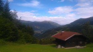
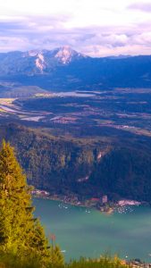
We got our room which is quite large but unfortunately opposite the reception desk so in the evening there was a lot going on for a while. But the view done from the hotel and our terrace was awesome!
In the evening we tried to find something to eat up here but the only two hotels which offered something to eat had either buffet or a 4 course dinner at 25 Euros each per person!
So we ate bananas, dried fruits and nuts from our emergency food provisions and chocolate. 😉
All in all, this stage was rather boring. Hopefully the way down to Ossiach gets a bit more exciting!
Btw, two pretty sayings for long distance hiking:
“Hiking is work of the legs and a state of the mind.” (Don’t know whom this is from, my mum sent it to me today.)
“Home is where my backpack is.” (Felix said this a few days ago, our slogan now. 😉)
Some figures for today :
- 19,7km
- 1340m up
- 690m down
- Hiking time: 4h 43m