Although we fell asleep rather early yesterday we were woken by thunderstorms and heavy rain at 5 a.m. This didn’t bear well for our planned early start to avoid the same in the evening…
Obviously I fell asleep again and dreamt stupid things about halestorms when at 6 a.m. the church bells rang in their concert. I think it lasted at least 5 minutes! 😱 Since we were wide awake by then we got up.
While we got ready and packed our backpacks it began to rain again. In the distance we heard the thunder roll. By the time we were downstairs for breakfast the thunderstorm was once more over Drežnica. Besides us all the other guests in the breakfast room were also hikers, so everyone was already up early and also not very happy about the weather. But at least the breakfast was really nice for only 5 Euros! Shortly, we considered hiking down to Kobarid and taking the bus to Tolmin when the rain stopped.
We quickly finished our breakfast and headed off without delay. The sky was very cloudy and partly looking like it could start to rain any second again and the air was very humid.
So when the path led upwards after 1km of even hiking on asphalt we soon began to sweat though it was still before 8 a.m. But I enjoyed it very much to hike upwards again after being in the plain during the last few days along the Soča.
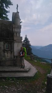
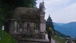
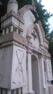
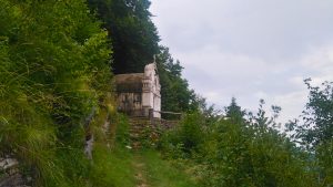
After one and a half hour and 5km we reached the highest point, the Planica Chapel at 1236m. It’s a small chapel built in memory to the Italian soldiers that died at the Isonzo front during the World War I.
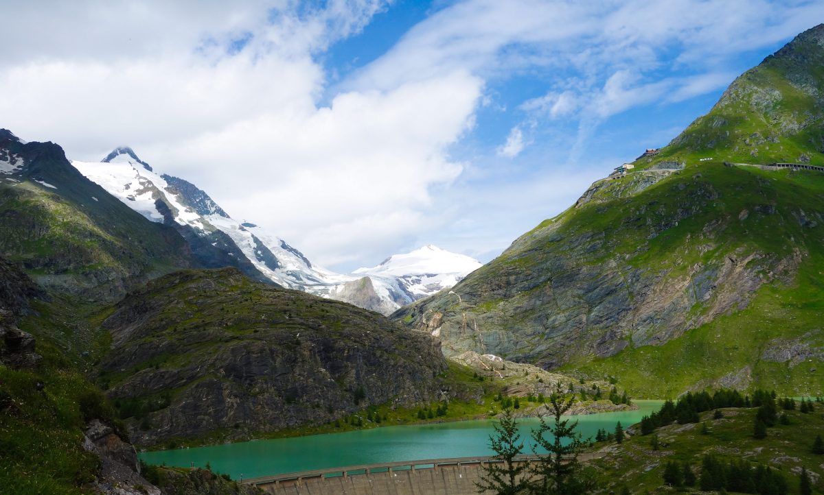
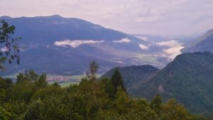
I was nearly sorry that it wouldn’t get any higher up because it felt so good again. The view up there was great though many clouds obscured the sight a little.
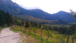
Afterwards the path led over alpine pastures with Slovenian cows (for the first time we saw cows in Slovenia so little had we obviously walked on pastures) and it was beautiful to hike! No one except us was around and up here the air was fresh and cool and a little breeze was cooling our sweaty faces. 😉
It was only 10 a.m. when we reached the mountain hut “Kuhinja”. Unfortunately the apple pie wasn’t ready yet 😉 so we got only something to drink. After 20 minutes or so we continued again; some of the other hikers were also just arriving and filing in – this hut being the only one on today’s stage.
From now on the path led downwards again. At first on asphalt road which after 2km turned into a 4×4 road and a quite rocky forest path.
The Slovenian forest path are usually littered with small stones and rocks and large boulders which makes it very hard to keep a reasonable pace. Especially when everything is wet from the rain it’s not very pleasant to hike.
It was a very long descent of 6km which took us nearly 2 hours. Then we came to an asphalt road again. Behind us there were already some dark clouds lurking in the sky and we heard thunder in the distance. But we were quite confident that it wouldn’t hit us.
The last 4km were a very boring 4×4 road with no shadow and nothing special to see so we dealt with them quickly. 😉
At 1.30 p.m. we arrived in Tolmin. Already now the Punk Rock festival which took place exactly these days casted its shadows and we saw some strange figures mainly dressed in black stuff with punk bands logos. 😉
We only found our accomodation, the Pension Rutar, after asking a girl from a newspaper stand. Our room and bathroom were quite big and after showering we went to a supermarket (a Hofer in fact!). There also the punks were to be found. 😉
When we went to a pizzeria to get something to eat it started to rain very heavily and then an enormous thunderstorm passed over. The waitress even had to close the sliding doors of the pub garden. We had to wait until the worst was over and so I took the chance and ate their homemade icecream. 😉 When we went back to our inn the rain finally got us.
Side note: although our guidebook stated that in 2015 the track was badly marked we can say that now it was one of the best marked sections of the whole trail! Never did we once have to wonder whether we were on the correct path.
Some figures for today:
- 24,1km
- 770m up
- 1170m down
- Hiking time: 4h 33m